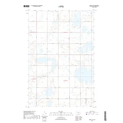
2018 Map of Kunkel Lake
USGS Topo · Published 2018About this map
The prairie landscape of Kunkel Lake in Kidder County is defined by a complex network of wetlands and seasonal basins. This 2018 survey illustrates the characteristic potholes of the region, where larger water bodies like Iowa Lake, Sink Lake, and South Lake are interspersed with smaller, unnamed depressions. The map reveals a rigid section-line road grid, including 38th Ave SE and 25th St SE, which dictates the layout of this agricultural territory. For those tracing family histories or local heritage, the inclusion of Fairview Cem on the eastern side of the quadrangle serves as a critical point of reference. The terrain is marked by gentle elevation changes and scattered marshes, illustrating the natural drainage patterns of central North Dakota.
Find a feature on this map
23 named features on this map. Tap any name to fly to it.
Don’t see what you’re looking for? This feature index may not catch every label — zoom into the map to look around manually.
Map Details
Editions of this 2018 Kunkel Lake Map
This is the sole edition of this map. No revisions or reprints were ever made.
Other maps of this area

1952 · Tappen NE
USGS Topo · 1:24,000

1952 · Tappen North
USGS Topo · 1:24,000

1952 · Steele NE
USGS Topo · 1:24,000

1952 · New Rockford
USGS Topo · 1:250,000

1953 · Jamestown
USGS Topo · 1:250,000

1956 · New Rockford
USGS Topo · 1:250,000

1956 · Jamestown
USGS Topo · 1:250,000

1971 · New Rockford
USGS Topo · 1:250,000

1972 · Kunkel Lake
USGS Topo · 1:24,000
1972 · Horsehead Lake
USGS Topo · 1:24,000