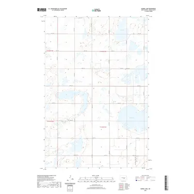
2020 Map of Kunkel Lake
USGS Topo · Published 2020About this map
Kunkel Lake defines the southeastern terrain of this central North Dakota landscape, situated within a prairie environment characterized by numerous seasonal and permanent water bodies. The geography here is defined by the classic pothole formations of the Missouri Coteau, where names like Sink Lake, Iowa Lake, and South Lake mark the depressions in the land. The human presence is structured by a rigid grid of rural roads, including 36th Ave SE and 25th St SE, which partition the townships for agricultural use. For those tracing local history, the Fairview Cem stands as a solitary landmark near the center of the sheet, providing a primary point of reference for ancestral research in this sparsely settled region of Kidder County.
Find a feature on this map
24 named features on this map. Tap any name to fly to it.
Don’t see what you’re looking for? This feature index may not catch every label — zoom into the map to look around manually.
Map Details
Editions of this 2020 Kunkel Lake Map
This is the sole edition of this map. No revisions or reprints were ever made.
Other maps of this area

1952 · Tappen NE
USGS Topo · 1:24,000

1952 · Tappen North
USGS Topo · 1:24,000

1952 · Steele NE
USGS Topo · 1:24,000

1952 · New Rockford
USGS Topo · 1:250,000

1953 · Jamestown
USGS Topo · 1:250,000

1956 · New Rockford
USGS Topo · 1:250,000

1956 · Jamestown
USGS Topo · 1:250,000

1971 · New Rockford
USGS Topo · 1:250,000

1972 · Kunkel Lake
USGS Topo · 1:24,000
1972 · Horsehead Lake
USGS Topo · 1:24,000