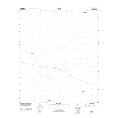
2011 Map of Kupk
USGS Topo · Published 2011About this map
Vamori Wash and a network of desert drainages define this Pima County landscape, where small settlements sit along the vital corridor of Indian Rte 24. This 2011 survey by the U.S. Geological Survey details the community of Kupk at the foot of the Kupk Hills, illustrating the desert's drainage patterns and scattered outposts like Tonuk Vo and Chicli-Vo. The terrain is shaped by broad alluvial fans and washes, including the San Luis Wash and Murk Kui Wash, which originate from higher elevations such as South Mountain. The map provides a clear picture of the arid environment of the Gu Oidak Valley, recording the precise placement of local landmarks like Chiweton Hill and the settlement of Chuwut Murk during the early 21st century.
Find a feature on this map
15 named features on this map. Tap any name to fly to it.
Don’t see what you’re looking for? This feature index may not catch every label — zoom into the map to look around manually.
Map Details
Editions of this 2011 Kupk Map
This is the sole edition of this map. No revisions or reprints were ever made.
Other maps of this area

1953 · Ajo
USGS Topo · 1:250,000

1954 · Sonoyta
USGS Topo · 1:250,000

1957 · Ajo
USGS Topo · 1:250,000

1958 · Ajo
USGS Topo · 1:250,000

1962 · Ajo
USGS Topo · 1:250,000

1963 · Ajo
USGS Topo · 1:250,000

1963 · Kom Vo
USGS Topo · 1:62,500

1963 · Gu Oidak
USGS Topo · 1:62,500

1963 · Quijotoa Mts
USGS Topo · 1:62,500

1963 · Pisinimo
USGS Topo · 1:62,500
Featured Places
- Kupk, Pisinemo District
- Chukut Kuk District, AZ
- Pisinemo District, AZ
- Sells, AZ
- Chuwut Murk, Pisinemo District