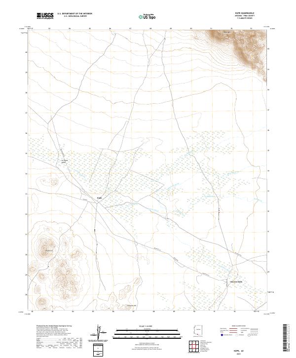
2021 Map of Kupk
USGS Topo · Published 2021About this map
Vamori Wash and its associated tributaries create a complex drainage network across this Pima County landscape, defining the local geography around the settlement of Kupk. The terrain transitions from the low-lying Gu Oidak Valley to prominent high points such as South Mtn in the northeast and the Kupk Hills in the southwest. Small residential clusters like Tonuk Vo and Chuwut Murk are connected by a sparse grid of rural routes including Indian Rte 24 and Rincon Rd. The map illustrates a desert environment where seasonal watercourses like Murk Kui Wash and San Luis Wash dictate the placement of infrastructure and small communities. This survey provides a look at the desert floor's natural drainage patterns and the isolated hills, such as Chiweton Hill, that serve as landmarks in this remote region.
Find a feature on this map
24 named features on this map. Tap any name to fly to it.
Don’t see what you’re looking for? This feature index may not catch every label — zoom into the map to look around manually.
Map Details
Editions of this 2021 Kupk Map
This is the sole edition of this map. No revisions or reprints were ever made.
Other maps of this area

1953 · Ajo
USGS Topo · 1:250,000

1954 · Sonoyta
USGS Topo · 1:250,000

1957 · Ajo
USGS Topo · 1:250,000

1958 · Ajo
USGS Topo · 1:250,000

1962 · Ajo
USGS Topo · 1:250,000

1963 · Ajo
USGS Topo · 1:250,000

1963 · Kom Vo
USGS Topo · 1:62,500

1963 · Gu Oidak
USGS Topo · 1:62,500

1963 · Quijotoa Mts
USGS Topo · 1:62,500

1963 · Pisinimo
USGS Topo · 1:62,500
Featured Places
- Kupk, Pisinemo District
- Chuwut Murk, Pisinemo District
- Chukut Kuk District, AZ
- Pisinemo District, AZ
- Sells, AZ