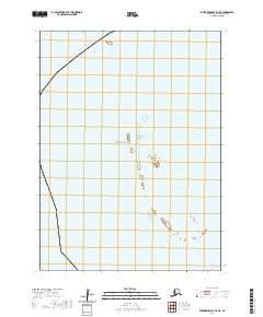
2020 Map of Kuskokwim Bay D-7 NE
USGS Topo · Published 2020About this map
The waters of the Bering Sea dominate this marine-focused survey, showcasing the isolated landmass of Kikegtek Island. Located within the Bethel Census Area of Alaska, this chart emphasizes the coastal transition and maritime boundaries of the Kuskokwim Bay region. The map provides precise Public Land Survey System coordinates, detailing townships t2s r88w and t2s r87w alongside their southern counterparts. As a modern study of these remote northern waters, it serves as a critical reference for understanding the shoreline position and the small island features that characterize this stretch of the Alaskan coast.
Find a feature on this map
6 named features on this map. Tap any name to fly to it.
Don’t see what you’re looking for? This feature index may not catch every label — zoom into the map to look around manually.
Map Details
Editions of this 2020 Kuskokwim Bay D-7 NE Map
This is the sole edition of this map. No revisions or reprints were ever made.
Other maps of this area

1951 · Kuskokwim Bay
USGS Topo · 1:250,000

1951 · Baird Inlet
USGS Topo · 1:250,000

1954 · Baird Inlet
USGS Topo · 1:250,000

1954 · Kuskokwim Bay
USGS Topo · 1:250,000
1954 · Kuskokwim Bay D-6
USGS Topo · 1:63,360
1954 · Baird Inlet A-7
USGS Topo · 1:63,360
1954 · Kuskokwim Bay D-7
USGS Topo · 1:63,360
1954 · Baird Inlet A-6
USGS Topo · 1:63,360
2020 · Kuskokwim Bay D-6 NW
USGS Topo · 1:25,000
2020 · Kuskokwim Bay D-6 SW
USGS Topo · 1:25,000