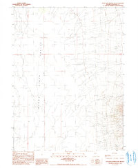
1990 Map of Kyle Hot Springs SW
USGS Topo · Published 1990About this map
Buena Vista Valley dominates this 1990 provisional survey, showcasing a landscape defined by the vast, dry expanse of the Alkali Flat. The map captures the transition from the level basin floor into the rising elevations of the Humboldt Range, where Woody Canyon cuts through the eastern slopes. As a provisional edition produced from 1950s aerial photography and 1980s field checks, it serves as a precise record of the topography and drainage patterns in this part of Pershing County. The absence of modern infrastructure underscores the area's isolation, with only basic unimproved routes and section lines for Township 29 North and 28 North providing a grid for orientation across the sagebrush and salt crust terrain.
Find a feature on this map
5 named features on this map. Tap any name to fly to it.
Don’t see what you’re looking for? This feature index may not catch every label — zoom into the map to look around manually.
Map Details
Editions of this 1990 Kyle Hot Springs SW Map
This is the sole edition of this map. No revisions or reprints were ever made.
Other maps of this area

1931 · Lovelock
USGS Topo · 1:250,000

1932 · Sonoma Range
USGS Topo · 1:250,000

1935 · Lovelock
USGS Topo · 1:250,000

1939 · Sonoma Range
USGS Topo · 1:250,000

1954 · Unionville
USGS Topo · 1:62,500

1954 · Buffalo Mtn
USGS Topo · 1:62,500

1955 · Lovelock
USGS Topo · 1:250,000

1955 · Winnemucca
USGS Topo · 1:250,000

1958 · Winnemucca
USGS Topo · 1:250,000

1959 · Lovelock
USGS Topo · 1:250,000