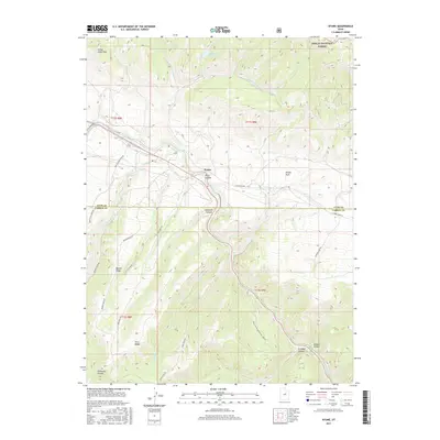
2017 Map of Kyune
USGS Topo · Published 2017About this map
Kyune sits as a central point of reference along the Price River as it carves through the high plateau country of central Utah. This 2017 survey details the complex drainage systems that define the border between Utah and Carbon Counties, where the water from Kyune Reservoir feeds into Kyune Cr. The landscape is dominated by significant topographical features such as Indian Head Peak and Beaver Ridge, while the eastern portion of the map is anchored by the Ashley National Forest. Deep incisions in the earth are noted by Price Canyon and Diamanti Canyon, showcasing the erosive power of the local river network. Transport through this high-elevation terrain is facilitated by a network of specialized routes including Bristle Cone Camp Rd and the Price Canyon Recreation Area Rd, providing access to the rugged ridges and meadows like Emma Park.
Find a feature on this map
35 named features on this map. Tap any name to fly to it.
Don’t see what you’re looking for? This feature index may not catch every label — zoom into the map to look around manually.
Map Details
Editions of this 2017 Kyune Map
This is the sole edition of this map. No revisions or reprints were ever made.
Other maps of this area

1885 · Manti
USGS Topo · 1:250,000

1886 · Price River
USGS Topo · 1:250,000

1895 · Manti
USGS Topo · 1:250,000

1896 · Price River
USGS Topo · 1:250,000

1914 · Castle Gate
USGS Topo · 1:62,500

1916 · Castle Gate
USGS Topo · 1:62,500

1923 · Scofield
USGS Topo · 1:62,500

1925 · Scofield
USGS Topo · 1:62,500

1939 · Soldier Summit
USGS Topo · 1:62,500

1942 · Soldier Summit
USGS Topo · 1:62,500