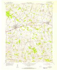
1954 Map of La Center
USGS Topo · Published 1955About this map
La Center serves as the focal point of this mid-century Western Kentucky landscape, situated along the Illinois Central railroad. The map reveals a rural economy structured around small settlements and an extensive network of family-named landmarks and country institutions. The Ballard Memorial Sch stands as a central community hub, while the terrain is dotted with numerous local burial grounds such as Terrell Cem, Hines Cem, and Newton Cem.
Find a feature on this map
44 named features on this map. Tap any name to fly to it.
Don’t see what you’re looking for? This feature index may not catch every label — zoom into the map to look around manually.
Map Details
Editions of this 1954 La Center Map
This is the sole edition of this map. No revisions or reprints were ever made.
Other maps of this area

1928 · La Center
USGS Topo · 1:62,500

1931 · Cairo
USGS Topo · 1:62,500

1932 · La Center
USGS Topo · 1:62,500

1933 · Cairo
USGS Topo · 1:62,500

1939 · Wickliffe
USGS Topo · 1:62,500

1939 · Cairo
USGS Topo · 1:62,500

1949 · Paducah
USGS Topo · 1:250,000

1950 · Paducah
USGS Topo · 1:250,000

1951 · Blandville
USGS Topo · 1:24,000

1951 · Wickliffe
USGS Topo · 1:24,000