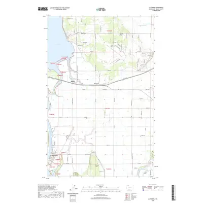
2020 Map of La Conner
USGS Topo · Published 2020About this map
La Conner anchors the southwestern corner of this coastal landscape, situated along the Swinomish Channel where it meets Skagit Bay. This 2020 record illustrates the intricate water systems of the Skagit delta, including the North Fork Skagit River and the agricultural expanse of the La Conner Flats. The map reveals a land defined by its drainage and elevation, from the marshes of Joe Leary Slough and Olympia Marsh in the north to the rising ground of Bay View Ridge and Pleasant Ridge. Genealogists and local historians can locate long-standing community landmarks such as Bay View Cem and Pleasant Ridge Cem, alongside small established settlements like Whitney, Fredonia, and Bay View. Modern infrastructure is represented by the Skagit Regional Airport, which occupies a significant portion of the central plateau.
Find a feature on this map
89 named features on this map. Tap any name to fly to it.
Don’t see what you’re looking for? This feature index may not catch every label — zoom into the map to look around manually.
Map Details
Editions of this 2020 La Conner Map
This is the sole edition of this map. No revisions or reprints were ever made.
Other maps of this area

1911 · Mount Vernon
USGS Topo · 1:125,000

1918 · Samish Lake
USGS Topo · 1:62,500

1940 · Mt Vernon
USGS Topo · 1:62,500

1943 · Mt Vernon
USGS Topo · 1:62,500

1943 · Deception Pass
USGS Topo · 1:62,500

1943 · Anacortes
USGS Topo · 1:62,500

1951 · Deception Pass
USGS Topo · 1:62,500

1951 · Anacortes
USGS Topo · 1:62,500

1952 · Alger
USGS Topo · 1:24,000

1954 · Bow
USGS Topo · 1:24,000