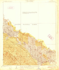
1928 Map of La Crescenta
USGS Topo · Published 1928About this map
Settlements along the southern slopes of the Verdugo Mountains define this landscape during a period of rapid development. The map details the emergence of communities like La Crescenta and Montrose, where a grid of residential streets is already well-established. These foothill towns are bounded by the steep wilderness of the Angeles National Forest to the north and the City of Los Angeles to the west.
Find a feature on this map
27 named features on this map. Tap any name to fly to it.
Don’t see what you’re looking for? This feature index may not catch every label — zoom into the map to look around manually.
Map Details
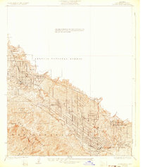
Editions of this 1928 La Crescenta Map
2 editions found
Other maps of this area

1894 · Los Angeles
USGS Topo · 1:62,500

1896 · Pasadena
USGS Topo · 1:62,500

1896 · Santa Monica
USGS Topo · 1:62,500

1898 · Santa Monica
USGS Topo · 1:62,500

1900 · Pasadena
USGS Topo · 1:62,500

1900 · Tujunga
USGS Topo · 1:62,500

1900 · Los Angeles
USGS Topo · 1:62,500

1900 · Fernando
USGS Topo · 1:62,500

1901 · Southern California Sheet No. 1
USGS Topo · 1:250,000

1902 · Santa Monica
USGS Topo · 1:62,500