
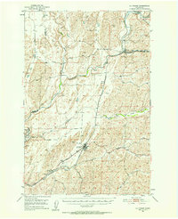
1950 Map of La Crosse
USGS Topo · Published 1950About this map
The Palouse River and its tributary system define the agricultural geography of this Whitman County region at mid-century. The Union Pacific railroad serves as the primary spine of the landscape, connecting the clustered settlements of Winona, Sutton, and La Crosse. This town-and-rail network reflects the grain-shipping economy central to the Palouse, where the movement of goods followed the natural breaks of Union Flat Creek and Willow Creek. North of the town center, the La Crosse Municipal Airport and a nearby Airway Beacon signal the modernization of transportation alongside the traditional rail corridor. Further south, the map identifies the small community of Pampa and Pampa Pond, while the northwestern corner marks the boundary between Adams and Whitman Counties. The terrain is characterized by intricate coulees and flats typical of the Columbia Plateau, illustrated through the drainage of Rebel Flat Creek and Rock Creek.
Find a feature on this map
18 named features on this map. Tap any name to fly to it.
Don’t see what you’re looking for? This feature index may not catch every label — zoom into the map to look around manually.
Map Details
Editions of this 1950 La Crosse Map
2 editions found
Other maps of this area

1948 · Starbuck
USGS Topo · 1:62,500

1950 · Starbuck
USGS Topo · 1:62,500

1950 · Penawawa
USGS Topo · 1:62,500

1950 · Endicott
USGS Topo · 1:62,500

1950 · Hay
USGS Topo · 1:62,500

1950 · Benge
USGS Topo · 1:62,500

1952 · Hay
USGS Topo · 1:62,500

1952 · La Crosse
USGS Topo · 1:62,500

1952 · Benge
USGS Topo · 1:62,500

1953 · Walla Walla
USGS Topo · 1:250,000