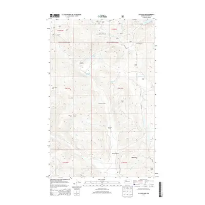
2014 Map of La Fleur Lake
USGS Topo · Published 2014About this map
The Colville Indian Reservation and Colville National Forest meet in this mountain landscape where traditional ranching and recreational use define the land. The settlement of Inchelium is visible in the southeast, situated near the headwaters of Abraham Cr. The map documents a rugged topography of high peaks and deep canyons, including Tungsten Mtn, Little White Mtn, and the distinctive Chipmunk Canyon. Water is central to this region, with La Fleur Lake and Lake Ellen providing focal points in the higher elevations. Historical land use is evidenced by several named agricultural holdings such as Chief Barnaby Ranch and Banning Ranch. Transportation through the timbered terrain follows the natural drainages of Barnaby Cr and Hall Cr, connecting isolated campgrounds like Elbow Lake Campground to the wider valley.
Find a feature on this map
43 named features on this map. Tap any name to fly to it.
Don’t see what you’re looking for? This feature index may not catch every label — zoom into the map to look around manually.
Map Details
Editions of this 2014 La Fleur Lake Map
This is the sole edition of this map. No revisions or reprints were ever made.
Other maps of this area

1936 · Marcus
USGS Topo · 1:96,000

1942 · Marcus
USGS Topo · 1:125,000

1948 · Sherman Peak
USGS Topo · 1:62,500

1948 · Kettle Falls
USGS Topo · 1:62,500

1950 · Inchelium
USGS Topo · 1:62,500

1951 · Sherman Peak
USGS Topo · 1:62,500

1951 · Kettle Falls
USGS Topo · 1:62,500

1952 · Twin Lakes
USGS Topo · 1:62,500

1954 · Okanogan
USGS Topo · 1:250,000

1958 · Okanogan
USGS Topo · 1:250,000