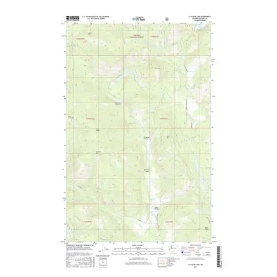
2017 Map of La Fleur Lake
USGS Topo · Published 2017About this map
Colville National Forest dominates this section of Ferry County, where the Kettle River Range landscape is defined by high peaks and high-elevation meadows. The geography is anchored by prominent heights such as Tungsten Mtn, Ant Mtn, and Little White Mtn, with drainage systems like Onion Cr and Barnaby Cr carving deep into the terrain. Small, secluded water bodies including Sugar Lake and LaFleur Lake are scattered throughout the forest, often accessible only via primitive routes like Elbow Lake Rd or Barnaby Creek Rd. Settled clearings such as Peppermint Meadows and LaFleur Meadows provide rare open ground amid the dense timber. In the southern reaches, Co Hwy 99 follows the path of Hall Cr, providing a primary artery through this remote mountain corridor near Bear Springs.
Find a feature on this map
40 named features on this map. Tap any name to fly to it.
Don’t see what you’re looking for? This feature index may not catch every label — zoom into the map to look around manually.
Map Details
Editions of this 2017 La Fleur Lake Map
This is the sole edition of this map. No revisions or reprints were ever made.
Other maps of this area

1936 · Marcus
USGS Topo · 1:96,000

1942 · Marcus
USGS Topo · 1:125,000

1948 · Sherman Peak
USGS Topo · 1:62,500

1948 · Kettle Falls
USGS Topo · 1:62,500

1950 · Inchelium
USGS Topo · 1:62,500

1951 · Sherman Peak
USGS Topo · 1:62,500

1951 · Kettle Falls
USGS Topo · 1:62,500

1952 · Twin Lakes
USGS Topo · 1:62,500

1954 · Okanogan
USGS Topo · 1:250,000

1958 · Okanogan
USGS Topo · 1:250,000