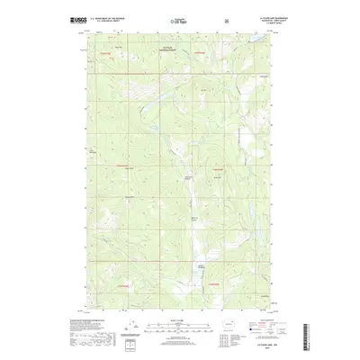
2020 Map of La Fleur Lake
USGS Topo · Published 2020About this map
Colville National Forest dominates this landscape in northern Washington, where the terrain is defined by a series of prominent peaks and high meadows. Tungsten Mtn and Onion Ridge overlook a network of seasonal drainages and small lakes, including La Fleur Lake and Lake Ellen. The naming conventions throughout the area, such as Peppermint Meadows, Finley Meadows, and LaFleur Meadows, suggest a history of seasonal grazing or early homesteading within these high-elevation clearings. Access to these remote sections of Ferry County is provided by a system of Forest Service and county roads, such as Elbow Lake Rd and CO Hwy 99, which follow the natural contours of the canyons. The presence of Butterfly Canyon and Chipmunk Canyon further illustrates the varied topography of this heavily forested region.
Find a feature on this map
42 named features on this map. Tap any name to fly to it.
Don’t see what you’re looking for? This feature index may not catch every label — zoom into the map to look around manually.
Map Details
Editions of this 2020 La Fleur Lake Map
This is the sole edition of this map. No revisions or reprints were ever made.
Other maps of this area

1936 · Marcus
USGS Topo · 1:96,000

1942 · Marcus
USGS Topo · 1:125,000

1948 · Sherman Peak
USGS Topo · 1:62,500

1948 · Kettle Falls
USGS Topo · 1:62,500

1950 · Inchelium
USGS Topo · 1:62,500

1951 · Sherman Peak
USGS Topo · 1:62,500

1951 · Kettle Falls
USGS Topo · 1:62,500

1952 · Twin Lakes
USGS Topo · 1:62,500

1954 · Okanogan
USGS Topo · 1:250,000

1958 · Okanogan
USGS Topo · 1:250,000