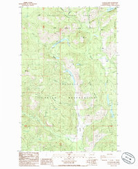
1985 Map of La Fleur Lake
USGS Topo · Published 1985About this map
Colville National Forest and the northern border of the Colville Indian Reservation define this landscape in Ferry County, where the terrain is dominated by high ridges and mountain peaks. The map details a transition from the dense woodlands of Rainy Ridge and Onion Ridge to more isolated family holdings, including Chief Barnaby Ranch and Banning Ranch. These labels hint at a long history of cattle grazing and homesteading in the valleys formed by Barnaby Creek and Onion Creek.
Find a feature on this map
36 named features on this map. Tap any name to fly to it.
Don’t see what you’re looking for? This feature index may not catch every label — zoom into the map to look around manually.
Map Details
Editions of this 1985 La Fleur Lake Map
This is the sole edition of this map. No revisions or reprints were ever made.
Other maps of this area

1936 · Marcus
USGS Topo · 1:96,000

1942 · Marcus
USGS Topo · 1:125,000

1948 · Sherman Peak
USGS Topo · 1:62,500

1948 · Kettle Falls
USGS Topo · 1:62,500

1950 · Inchelium
USGS Topo · 1:62,500

1951 · Sherman Peak
USGS Topo · 1:62,500

1951 · Kettle Falls
USGS Topo · 1:62,500

1952 · Twin Lakes
USGS Topo · 1:62,500

1954 · Okanogan
USGS Topo · 1:250,000

1958 · Okanogan
USGS Topo · 1:250,000