
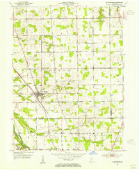
1953 Map of La Fontaine
USGS Topo · Published 1954About this map
La Fontaine serves as the central hub of this mid-century Indiana landscape, where the New York Central railroad tracks bisect the town as they run southeast toward the Mississinewa River. The surrounding townships of Liberty, Noble, and Washington are dotted with family and community landmarks vital to local genealogy, including the Stone Cem, America Cem, and the Meshingomesia Cem located near the southern boundary. The presence of the Lincolnville Airfield to the north and the Hendricks Sch near Jalapa reflects the rural infrastructure of the early 1950s. Waterways like Grant Creek and Metocinah Creek drain the agricultural terrain, illustrating the historical drainage patterns before modern land development altered the local hydrology.
Find a feature on this map
32 named features on this map. Tap any name to fly to it.
Don’t see what you’re looking for? This feature index may not catch every label — zoom into the map to look around manually.
Map Details
Editions of this 1953 La Fontaine Map
2 editions found
Other maps of this area

1950 · Lagro
USGS Topo · 1:24,000

1950 · Andrews
USGS Topo · 1:24,000

1950 · Mount Etna
USGS Topo · 1:24,000

1951 · Mount Etna
USGS Topo · 1:24,000

1951 · Andrews
USGS Topo · 1:24,000

1951 · Lagro
USGS Topo · 1:24,000

1952 · Wabash
USGS Topo · 1:24,000

1953 · Somerset
USGS Topo · 1:24,000

1953 · Muncie
USGS Topo · 1:250,000

1956 · Muncie
USGS Topo · 1:250,000