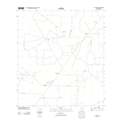
2012 Map of La Gloria
USGS Topo · Published 2012About this map
Santa Catarina and Santa Anna sit at the center of this South Texas landscape, defined by a network of ranch roads and remote energy infrastructure. The layout reflects a deeply rooted ranching economy where property boundaries often dictate the path of local thoroughfares like Santa Caterina Rd and Alaniz Brothers Ln. This 2012 survey illustrates the continued importance of land-holding names such as Robberson and the Diamond O Ranch, the latter of which features its own Diamond O Ranch Airport.
Find a feature on this map
27 named features on this map. Tap any name to fly to it.
Don’t see what you’re looking for? This feature index may not catch every label — zoom into the map to look around manually.
Map Details
Editions of this 2012 La Gloria Map
This is the sole edition of this map. No revisions or reprints were ever made.
Other maps of this area

1938 · Agua Nueva
USGS Topo · 1:62,500

1938 · Sal Colorada
USGS Topo · 1:62,500

1939 · La Reforma
USGS Topo · 1:62,500

1939 · Encantada
USGS Topo · 1:62,500

1949 · Mc Allen
USGS Topo · 1:250,000

1954 · McAllen
USGS Topo · 1:250,000

1957 · Mc Allen
USGS Topo · 1:250,000

1962 · McAllen
USGS Topo · 1:250,000
1972 · San Isidro
USGS Topo · 1:24,000
1972 · Bentsen Ranch
USGS Topo · 1:24,000