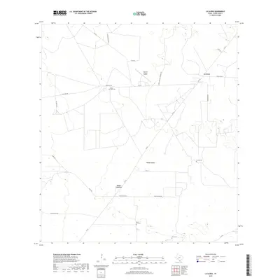
2019 Map of La Gloria
USGS Topo · Published 2019About this map
Santa Catarina and the adjacent ranching landscapes of Starr County are captured here in the late 2010s. This territory is defined by a network of long, straight ranch roads and farm-to-market routes like FM 755 and FM 1017, which connect several small communities and family-owned properties. The map reveals a cluster of local history sites, including the Tangue Allegre Cem and San Jose Cem, which serve as vital markers of the area's genealogical heritage. To the north, La Gloria sits near the intersection of Ranch Rd 1017 and FM 755, while the Diamond O Ranch Airport suggests the importance of private aviation in managing these large South Texas estates. The terrain is marked by numerous ephemeral drainage patterns and small depressions, highlighting the semi-arid character of this cattle country.
Find a feature on this map
24 named features on this map. Tap any name to fly to it.
Don’t see what you’re looking for? This feature index may not catch every label — zoom into the map to look around manually.
Map Details
Editions of this 2019 La Gloria Map
This is the sole edition of this map. No revisions or reprints were ever made.
Other maps of this area

1938 · Agua Nueva
USGS Topo · 1:62,500

1938 · Sal Colorada
USGS Topo · 1:62,500

1939 · La Reforma
USGS Topo · 1:62,500

1939 · Encantada
USGS Topo · 1:62,500

1949 · Mc Allen
USGS Topo · 1:250,000

1954 · McAllen
USGS Topo · 1:250,000

1957 · Mc Allen
USGS Topo · 1:250,000

1962 · McAllen
USGS Topo · 1:250,000
1972 · San Isidro
USGS Topo · 1:24,000
1972 · Bentsen Ranch
USGS Topo · 1:24,000