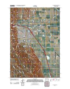
2011 Map of La Grande
USGS Topo · Published 2011About this map
La Grande serves as the focal point of this Eastern Oregon valley, situated at the base of the Blue Mountains where the Grande Ronde River and numerous irrigation canals like Grande Ronde Ditch define the agricultural landscape. The map highlights the town's role as a regional center, featuring the campus of Eastern Oregon University and the La Grande Post Office. The surrounding terrain transitions sharply from the flat valley floor to the prominent heights of Table Mountain and Rooster Peak to the west. Irrigation is a dominant theme of the local geography, evidenced by an intricate network of waterways including Pierce Slough, Mulholland Slough, and Gekeler Slough. This detailed survey also documents several historic burial grounds, including Hillcrest Cemetery, Grandview Cemetery, and the Island City Cemetery, which provide significant value for genealogical research in Union County.
Find a feature on this map
63 named features on this map. Tap any name to fly to it.
Don’t see what you’re looking for? This feature index may not catch every label — zoom into the map to look around manually.
Map Details
Editions of this 2011 La Grande Map
This is the sole edition of this map. No revisions or reprints were ever made.
Other maps of this area

1906 · Telocaset
USGS Topo · 1:125,000

1953 · Pendleton
USGS Topo · 1:250,000

1955 · Grangeville
USGS Topo · 1:250,000

1956 · Pendleton
USGS Topo · 1:250,000

1959 · Grangeville
USGS Topo · 1:250,000

1963 · La Grande SE
USGS Topo · 1:24,000

1963 · Hilgard
USGS Topo · 1:24,000

1963 · Summerville
USGS Topo · 1:24,000

1964 · Drumhill Ridge
USGS Topo · 1:24,000

1965 · Conley
USGS Topo · 1:24,000