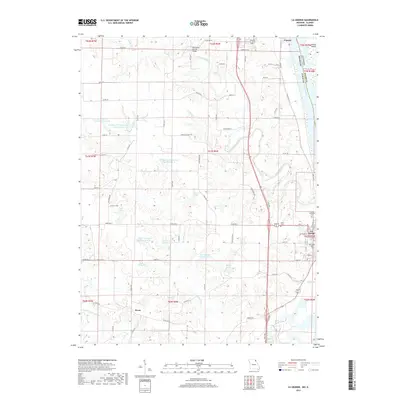
2017 Map of La Grange
USGS Topo · Published 2017About this map
The Mississippi River corridor in northeast Missouri anchors this landscape, where the river serves as the state boundary between Lewis County, Missouri, and Illinois. The riverfront town of La Grange sits at the southern end of the sheet, characterized by its grid of streets including Jefferson Street and Pierce Street, and the prominent Riverview Cemetery overlooking the water. Northward, the settlement of Canton occupies the riverbank opposite Dillon Island.
Find a feature on this map
72 named features on this map. Tap any name to fly to it.
Don’t see what you’re looking for? This feature index may not catch every label — zoom into the map to look around manually.
Map Details
Editions of this 2017 La Grange Map
This is the sole edition of this map. No revisions or reprints were ever made.
Other maps of this area

1903 · Kahoka
USGS Topo · 1:125,000

1903 · Palmyra
USGS Topo · 1:125,000

1925 · Quincy
USGS Topo · 1:62,500

1944 · Quincy
USGS Topo · 1:62,500

1945 · Quincy
USGS Topo · 1:62,500

1946 · Mendon
USGS Topo · 1:62,500

1948 · Quincy
USGS Topo · 1:250,000

1948 · Mendon
USGS Topo · 1:62,500

1949 · Durham
USGS Topo · 1:24,000

1949 · Maywood
USGS Topo · 1:24,000