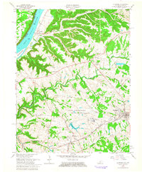
1961 Map of La Grange
USGS Topo · Published 1963About this map
The Ohio River forms the northwestern boundary of this 1961 revision, where the river valley meets the upland terrain of Oldham County. The landscape is defined by the massive State Reformatory Reservation, which occupies a central position on the map and includes its own Reformatory Lake, filtration plant, and internal road network. Settlement patterns are concentrated along the Louisville and Nashville railroad corridor, where the town of La Grange and the smaller community of Buckner are situated.
Find a feature on this map
54 named features on this map. Tap any name to fly to it.
Don’t see what you’re looking for? This feature index may not catch every label — zoom into the map to look around manually.
Map Details
Editions of this 1961 La Grange Map
This is the sole edition of this map. No revisions or reprints were ever made.
Other maps of this area

1905 · Prospect
USGS Topo · 1:62,500

1912 · Prospect
USGS Topo · 1:62,500

1932 · La Grange
USGS Topo · 1:62,500

1938 · Owen
USGS Topo · 1:24,000

1939 · Bethlehem
USGS Topo · 1:24,000

1948 · Bethlehem
USGS Topo · 1:24,000

1948 · Owen
USGS Topo · 1:24,000

1951 · Anchorage
USGS Topo · 1:24,000

1951 · Crestwood
USGS Topo · 1:24,000

1953 · Bedford
USGS Topo · 1:24,000