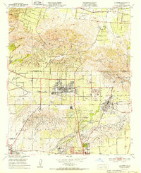
1952 Map of La Habra
USGS Topo · Published 1952About this map
La Habra and the surrounding borderlands of Los Angeles and Orange Counties appear here during a transformative era of mid-century growth. The landscape is defined by the prominent Puente Hills to the north and the Coyote Hills to the south, where early oil exploration is evidenced by numerous oil tanks, reservoirs, and wells dotting the hillsides. The transition from agricultural ranching to suburban development is visible in named properties like Murphy Ranch, Leffingwell Ranch, and Sunny Hills Ranch, which sit alongside established civic centers such as Brea and the northern reaches of Fullerton.
Find a feature on this map
49 named features on this map. Tap any name to fly to it.
Don’t see what you’re looking for? This feature index may not catch every label — zoom into the map to look around manually.
Map Details
Editions of this 1952 La Habra Map
2 editions found
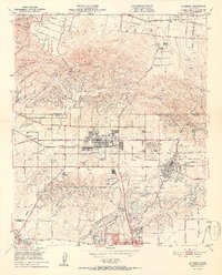
Other maps of this area

1894 · Los Angeles
USGS Topo · 1:62,500

1894 · Pomona
USGS Topo · 1:62,500

1896 · Pasadena
USGS Topo · 1:62,500

1896 · Anaheim
USGS Topo · 1:62,500

1896 · Downey
USGS Topo · 1:62,500

1897 · Pomona
USGS Topo · 1:62,500

1898 · Pomona
USGS Topo · 1:62,500

1898 · Anaheim
USGS Topo · 1:62,500

1899 · Downey
USGS Topo · 1:62,500

1900 · Pasadena
USGS Topo · 1:62,500