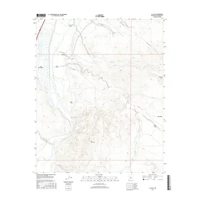
2017 Map of La Joya
USGS Topo · Published 2017About this map
The Rio Grande valley dictates the life and layout of this Socorro County landscape, where the ribbon of water supports the settlements of La Joya and San Geronimo. This 2017 study illustrates the intersection of ancient transit and modern topography, with named routes like Del Rio Camino and Cll De Centro Sur providing access through the valley floor. Away from the river, the land rises into a complex system of drainages, including Palo Duro Canyon and Cibola Canyon. Local history is anchored by the La Joya Cem and the small community of Los Cañoncitos. Water remains a central theme even in the arid uplands, marked by reliable points like Los Alamos Spring and Ojo del Padre. The presence of the Red Mill and various arroyos, such as Arroyo Rosa de Castillo, provides a detailed look at the drainage patterns that define the region's geography.
Find a feature on this map
21 named features on this map. Tap any name to fly to it.
Don’t see what you’re looking for? This feature index may not catch every label — zoom into the map to look around manually.
Map Details
Editions of this 2017 La Joya Map
This is the sole edition of this map. No revisions or reprints were ever made.
Other maps of this area

1906 · Socorro
USGS Topo · 1:62,500

1916 · La Joya
USGS Topo · 1:125,000

1952 · La Joya NW
USGS Topo · 1:24,000

1952 · San Anacia
USGS Topo · 1:24,000

1952 · Black Butte
USGS Topo · 1:24,000

1952 · La Joya
USGS Topo · 1:24,000

1952 · Becker SW
USGS Topo · 1:24,000

1952 · Abeytas
USGS Topo · 1:24,000

1954 · Socorro
USGS Topo · 1:250,000

1958 · Socorro
USGS Topo · 1:250,000