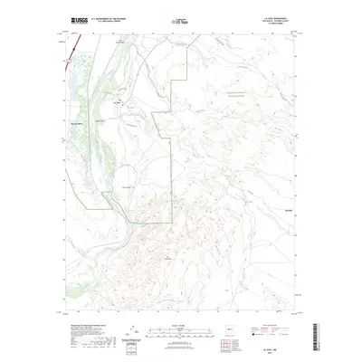
2023 Map of La Joya
USGS Topo · Published 2023About this map
La Joya and San Geronimo sit along the eastern banks of the Rio Grande in a landscape defined by deep drainage networks and the protected lands of the Sevilleta National Wildlife Refuge. The settlement pattern follows the river valley, where local routes like Del Rio Camino and Cll de Centro connect residential areas to the La Joya Cem. The surrounding terrain is a complex system of arroyos and canyons, including Palo Duro Canyon and the winding Salas Arroyo. Further east, the map reveals isolated landmarks and water sources such as the Red Mill, Los Alamos Spring, and the well-known Ojo del Padre. This 2023 survey illustrates the contrast between the fertile river corridor and the arid, broken country of Los Cañoncitos and Loma Parda.
Find a feature on this map
26 named features on this map. Tap any name to fly to it.
Don’t see what you’re looking for? This feature index may not catch every label — zoom into the map to look around manually.
Map Details
Editions of this 2023 La Joya Map
This is the sole edition of this map. No revisions or reprints were ever made.
Other maps of this area

1906 · Socorro
USGS Topo · 1:62,500

1916 · La Joya
USGS Topo · 1:125,000

1952 · La Joya NW
USGS Topo · 1:24,000

1952 · San Anacia
USGS Topo · 1:24,000

1952 · Black Butte
USGS Topo · 1:24,000

1952 · La Joya
USGS Topo · 1:24,000

1952 · Becker SW
USGS Topo · 1:24,000

1952 · Abeytas
USGS Topo · 1:24,000

1954 · Socorro
USGS Topo · 1:250,000

1958 · Socorro
USGS Topo · 1:250,000