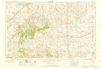
1958 Map of La Junta
USGS Topo · Published 1958About this map
The Arkansas River corridor and the high plains of Southeast Colorado define this mid-century landscape. Centered on the rail hub of La Junta, the map illustrates a region where water management through the Holbrook Canal and Otero Canal was essential for agriculture. To the south, the terrain shifts dramatically into the canyon-carved plateaus of Mesa De Maya and Chaquaqua Mesa, rising toward Carrizo Mountain.
Find a feature on this map
67 named features on this map. Tap any name to fly to it.
Don’t see what you’re looking for? This feature index may not catch every label — zoom into the map to look around manually.
Map Details
Editions of this 1958 La Junta Map
2 editions found

Other maps of this area

1890 · Granada
USGS Topo · 1:125,000

1891 · Catlin
USGS Topo · 1:125,000

1891 · Albany
USGS Topo · 1:125,000

1891 · Higbee
USGS Topo · 1:125,000

1891 · Las Animas
USGS Topo · 1:125,000

1891 · Timpas
USGS Topo · 1:125,000

1891 · Nepesta
USGS Topo · 1:125,000

1891 · Apishapa
USGS Topo · 1:125,000

1891 · Springfield
USGS Topo · 1:125,000

1891 · Mesa De Maya
USGS Topo · 1:125,000