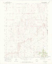
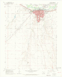
1966 Map of La Junta SE
USGS Topo · Published 1969About this map
Anderson Arroyo snakes across this high-plains landscape in southeastern Colorado, defining the drainage patterns through Otero County in the mid-1960s. The terrain is characterized by the significant incision of David Canyon, which cuts through the southern portion of the sheet, revealing the rugged erosional geography typical of the region. A notable industrial feature is the Pipeline that traverses the area, signaling the utility infrastructure supporting this cattle-country environment. Small-scale water sources like Vogel Springs and a remote Well are critical landmarks in this arid territory, where water often dictated the placement of ranching outposts and livestock routes. The map records the precise township and range boundaries, such as the junction of T. 25 S. and T. 26 S., which remain essential for local land title research and historical genealogy.
Find a feature on this map
8 named features on this map. Tap any name to fly to it.
Don’t see what you’re looking for? This feature index may not catch every label — zoom into the map to look around manually.
Map Details
Editions of this 1966 La Junta SE Map
4 editions found
Other maps of this area

1891 · Higbee
USGS Topo · 1:125,000

1891 · Timpas
USGS Topo · 1:125,000

1893 · Higbee
USGS Topo · 1:125,000

1894 · Timpas
USGS Topo · 1:125,000

1955 · La Junta
USGS Topo · 1:250,000

1958 · La Junta
USGS Topo · 1:250,000

1965 · La Junta SW
USGS Topo · 1:24,000

1966 · La Junta SE
USGS Topo · 1:24,000
1966 · Hawley
USGS Topo · 1:24,000
1966 · La Junta
USGS Topo · 1:24,000