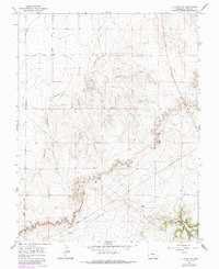
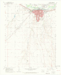
1966 Map of La Junta SE
USGS Topo · Published 1985About this map
Vogel Springs provides a focal point in the southeast corner of this Colorado landscape, where the high plains begin to break into the drainage systems of Vogel Canyon and the wider David Canyon. This 1960s-era topography, which includes revisions through the mid-1980s, reveals a terrain defined by its watercourses and transit routes through Otero County. The presence of Anderson Arroyo cutting through the center of the sheet highlights the seasonal water flow patterns critical to the local geography. Human impact is primarily noted through infrastructure like the Pipeline and Rourke Road, which traverse the open range between these deep canyon cuts, illustrating the sparse but vital network connecting these remote high plains cattle-grazing lands.
Find a feature on this map
6 named features on this map. Tap any name to fly to it.
Don’t see what you’re looking for? This feature index may not catch every label — zoom into the map to look around manually.
Map Details
Editions of this 1966 La Junta SE Map
4 editions found
Other maps of this area

1891 · Higbee
USGS Topo · 1:125,000

1891 · Timpas
USGS Topo · 1:125,000

1893 · Higbee
USGS Topo · 1:125,000

1894 · Timpas
USGS Topo · 1:125,000

1955 · La Junta
USGS Topo · 1:250,000

1958 · La Junta
USGS Topo · 1:250,000

1965 · La Junta SW
USGS Topo · 1:24,000

1966 · La Junta SE
USGS Topo · 1:24,000
1966 · Hawley
USGS Topo · 1:24,000
1966 · La Junta
USGS Topo · 1:24,000