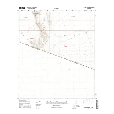
2014 Map of La Lesna Mountains
USGS Topo · Published 2014About this map
La Lesna Mountains dominate the northwestern landscape of this borderland survey, rising sharply above the expansive expanse of The Great Plain. This remote stretch of the Sonoran Desert is defined by its position along the international boundary between the United States of America and Estados Unidos Mexicanos. Sparse settlements such as Sivili Chuchg, Ak Komelik, and Tatum Vo are connected by Bureau of Indian Affairs routes like Bia-21 and Bia-12, reflecting the essential transport network of the Chukut Kuk District. The prominent La Lesna Peak serves as a significant landmark in a terrain otherwise characterized by dry washes and gradual alluvial fans that cross the Pima County line. The proximity to the Mexican border and the isolated nature of these small communities highlight the enduring cultural and geographic patterns of this arid region.
Find a feature on this map
15 named features on this map. Tap any name to fly to it.
Don’t see what you’re looking for? This feature index may not catch every label — zoom into the map to look around manually.
Map Details
Editions of this 2014 La Lesna Mountains Map
This is the sole edition of this map. No revisions or reprints were ever made.
Other maps of this area

1954 · Sonoyta
USGS Topo · 1:250,000

1963 · Kom Vo
USGS Topo · 1:62,500

1963 · Gu Oidak
USGS Topo · 1:62,500
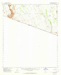
1963 · La Lesna Mts.
USGS Topo · 1:62,500

1963 · Lukeville
USGS Topo · 1:250,000
1988 · Chukut Kuk
USGS Topo · 1:24,000
1988 · Tecolote Ranch
USGS Topo · 1:24,000
1988 · Kots Kug Ranch
USGS Topo · 1:24,000
1988 · South of Papago Farms
USGS Topo · 1:24,000
1988 · Papago Farms
USGS Topo · 1:24,000
Featured Places
- Chukut Kuk District, AZ
- Sivili Chuchg, Chukut Kuk District
- Ak Komelik, Chukut Kuk District
- Pima County, AZ