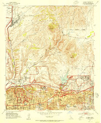
1953 Map of La Mesa
USGS Topo · Published 1955About this map
San Diego State College stands as a central landmark in this 1953 survey, illustrating the rapid post-war expansion of the San Diego area. The landscape transitions from the urban street grids of Normal Heights, Kensington Park, and East San Diego into the rugged canyonlands of Mission Gorge. Military activity is prominent along the northern reaches, dominated by Naval Air Station Miramar and the Camp Elliott Naval Reservation, while the historic Mission San Diego remains a fixed point of reference near the San Diego River.
Find a feature on this map
62 named features on this map. Tap any name to fly to it.
Don’t see what you’re looking for? This feature index may not catch every label — zoom into the map to look around manually.
Map Details
Editions of this 1953 La Mesa Map
3 editions found
Other maps of this area

1893 · El Cajon
USGS Topo · 1:62,500

1901 · Elcajon
USGS Topo · 1:62,500

1903 · Cuyamaca
USGS Topo · 1:125,000

1903 · La Jolla
USGS Topo · 1:62,500

1903 · Elcajon
USGS Topo · 1:62,500

1904 · San Diego
USGS Topo · 1:62,500

1904 · Southern California Sheet No. 2
USGS Topo · 1:250,000

1930 · La Jolla
USGS Topo · 1:62,500

1930 · San Diego
USGS Topo · 1:62,500

1939 · El Cajon
USGS Topo · 1:62,500