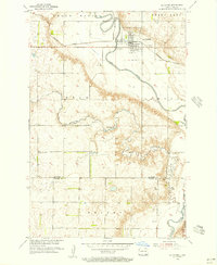
1955 Map of La Moure
USGS Topo · Published 1956About this map
The James River carves a winding path through the southeastern North Dakota prairie on this survey, anchoring the town of La Moure. The settlement is a hub of transport and water management in the mid-1950s, defined by the Northern Pacific railroad crossing and the Spillway 1297 at the river's bend. The landscape is marked by the distinct sections of Grand Rapids, Dean, Ryan, and Wright, showing a highly organized grid of rural infrastructure. Evidence of early community life is preserved in the placement of the Cottonwood Ch and the St Ansgar Ch near the Dickey County line. The map reveals a balance between the natural hydraulics of Nevermore Lake and Cottonwood Creek and the utilitarian needs of the era, seen in the numerous Gravel Pits and the Gaging Sta monitoring the river's flow.
Find a feature on this map
20 named features on this map. Tap any name to fly to it.
Don’t see what you’re looking for? This feature index may not catch every label — zoom into the map to look around manually.
Map Details
Editions of this 1955 La Moure Map
2 editions found
Other maps of this area

1894 · La Moure
USGS Topo · 1:62,500

1894 · Fullerton
USGS Topo · 1:62,500

1894 · Oakes
USGS Topo · 1:62,500

1895 · Lamoure
USGS Topo · 1:125,000

1918 · La Moure
USGS Topo · 1:125,000

1952 · Glover
USGS Topo · 1:24,000

1952 · Grand Rapids
USGS Topo · 1:24,000

1952 · Independence
USGS Topo · 1:24,000

1953 · Jamestown
USGS Topo · 1:250,000

1955 · Fullerton NE
USGS Topo · 1:24,000