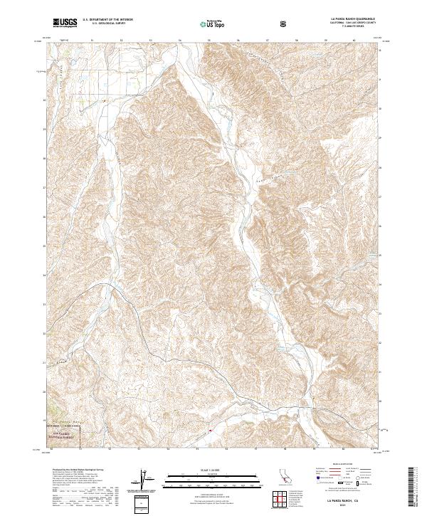
2021 Map of La Panza Ranch
USGS Topo · Published 2021About this map
The La Panza Range dominates the southern landscape of this California interior quadrangle, where the arid terrain is defined by an intricate network of intermittent drainages and named springs. Water sources such as Cedar Spring, Willow Spring, and Carnaza Spring suggest the historical importance of localized water points for ranching and travel in this part of San Luis Obispo County. The southwestern corner of the sheet includes a portion of the Los Padres National Forest, marking a transition into protected federal lands. Drainage patterns are led by San Juan Creek and Navajo Creek, which carve through the high-relief topography. The infrastructure is sparse, characterized by winding routes like Navajo Creek Rd and Carrisa Hwy, which follow the natural contours of the canyons and creek beds, providing a clear view of the rural ranching connectivity in the early twenty-first century.
Find a feature on this map
23 named features on this map. Tap any name to fly to it.
Don’t see what you’re looking for? This feature index may not catch every label — zoom into the map to look around manually.
Map Details
Editions of this 2021 La Panza Ranch Map
This is the sole edition of this map. No revisions or reprints were ever made.
Other maps of this area

1914 · Cholame
USGS Topo · 1:125,000

1915 · Cholame
USGS Topo · 1:125,000

1917 · Cholame
USGS Topo · 1:125,000

1922 · Pozo
USGS Topo · 1:62,500

1932 · La Panza
USGS Topo · 1:48,000

1935 · La Panza
USGS Topo · 1:62,500

1936 · La Panza
USGS Topo · 1:62,500

1943 · Packwood
USGS Topo · 1:31,680

1943 · Grant Lake
USGS Topo · 1:31,680

1943 · Commatti Canyon
USGS Topo · 1:31,680