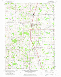
1972 Map of La Paz
USGS Topo · Published 1974About this map
La Paz serves as the central hub of this northern Indiana landscape, situated at a critical crossing where the Baltimore and Ohio railroad bisects the countryside. The map reveals a transition from the agricultural heritage of North and Union townships to the mid-century developments surrounding the LaVille High Sch. Community life is anchored by local congregations and landmarks such as Pine Creek Ch, Shiloh Ch, and the Mt Zion Cem Ch.
Find a feature on this map
87 named features on this map. Tap any name to fly to it.
Don’t see what you’re looking for? This feature index may not catch every label — zoom into the map to look around manually.
Map Details
Editions of this 1972 La Paz Map
2 editions found
Other maps of this area

1953 · Chicago
USGS Topo · 1:250,000

1957 · Chicago
USGS Topo · 1:250,000

1957 · Inwood
USGS Topo · 1:24,000

1957 · Plymouth
USGS Topo · 1:24,000

1958 · Donaldson
USGS Topo · 1:24,000

1958 · Bremen
USGS Topo · 1:24,000

1958 · La Paz
USGS Topo · 1:24,000

1958 · Walkerton
USGS Topo · 1:24,000

1958 · North Liberty
USGS Topo · 1:24,000

1958 · Lakeville
USGS Topo · 1:24,000