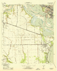
1944 Map of La Porte
USGS Topo · Published 1944About this map
The San Jacinto Monument stands as a prominent landmark on this 1944 survey, marking the historic grounds of San Jacinto State Park where the San Jacinto River meets San Jacinto Bay. This wartime-era mapping captures a landscape of emerging industrial infrastructure alongside traditional coastal settlements. The Houston Ship Channel dominates the northern waterways, facilitating heavy maritime traffic past Peggy Lake and Mitchell Bay. To the south, the established towns of Deer Park and La Porte are shown with their detailed street grids, connected by the 4 Lane Southern Pacific railroad and the Spencer Highway. Along the shoreline of Galveston Bay, the resort-like character of Sylvan Beach and Bayside Terrace contrasts with the surrounding wetlands and bayous, such as Big Island Slough and Willow Springs Bayou, illustrating the mid-century development of the Texas Gulf Coast.
Find a feature on this map
54 named features on this map. Tap any name to fly to it.
Don’t see what you’re looking for? This feature index may not catch every label — zoom into the map to look around manually.
Map Details
Editions of this 1944 La Porte Map
This is the sole edition of this map. No revisions or reprints were ever made.
Other maps of this area

1915 · Deepwater
USGS Topo · 1:24,000

1916 · Genoa
USGS Topo · 1:24,000

1916 · Burnett Bay
USGS Topo · 1:24,000

1916 · Morgan Point
USGS Topo · 1:24,000

1916 · Seabrook
USGS Topo · 1:24,000

1916 · Fauna
USGS Topo · 1:24,000

1916 · Cedar Bayou
USGS Topo · 1:24,000

1916 · La Porte
USGS Topo · 1:24,000

1919 · Morgan Point
USGS Topo · 1:31,680

1919 · Deepwater
USGS Topo · 1:31,680