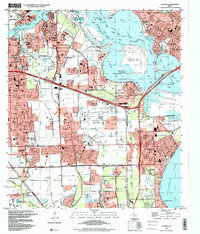
1995 Map of La Porte
USGS Topo · Published 1999About this map
The San Jacinto Monument stands as a sentinel over the convergence of the San Jacinto River and the Buffalo Bayou, marking a landscape defined by heavy industry and deep-water maritime transit. In the mid-1990s, this area reflects the massive industrial footprint of the Texas Gulf Coast, with the expansive Barbours Cut terminal and the Jacintoport complex facilitating international trade via the Ship Channel. Residential growth in La Porte, Deer Park, and Pasadena is captured here, showing the proximity of suburban neighborhoods to significant landmarks like San Jacinto College and the Baywood Country Club. The map provides a detailed view of the infrastructure supporting this hub, from the Missouri Pacific railroad lines to the Hartman Bridge and the Baytown Tunnel, illustrating how the region's geography was reshaped to accommodate both the petrochemical industry and a growing population.
Find a feature on this map
61 named features on this map. Tap any name to fly to it.
Don’t see what you’re looking for? This feature index may not catch every label — zoom into the map to look around manually.
Map Details
Editions of this 1995 La Porte Map
This is the sole edition of this map. No revisions or reprints were ever made.
Other maps of this area

1915 · Deepwater
USGS Topo · 1:24,000

1916 · Genoa
USGS Topo · 1:24,000

1916 · Burnett Bay
USGS Topo · 1:24,000

1916 · Morgan Point
USGS Topo · 1:24,000

1916 · Seabrook
USGS Topo · 1:24,000

1916 · Fauna
USGS Topo · 1:24,000

1916 · Cedar Bayou
USGS Topo · 1:24,000

1916 · La Porte
USGS Topo · 1:24,000

1919 · Morgan Point
USGS Topo · 1:31,680

1919 · Deepwater
USGS Topo · 1:31,680