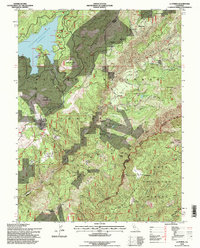
1994 Map of La Porte
USGS Topo · Published 1998About this map
Gold-bearing ravines and high ridges define this landscape where the boundaries of Plumas Co Sierra Co meet. The area’s hydraulic and placer mining legacy is visible through a complex network of ditches and remnants like the Pioneer Mine Placer Diggings and the Thistle Shaft (Site). Settlements such as Gibsonville and Howland Flat occupy the high ground between deep drainages like Canyon Creek and Slate Creek, reflecting a settlement pattern dictated by the geology of the Mother Lode's northern reaches.
Find a feature on this map
61 named features on this map. Tap any name to fly to it.
Don’t see what you’re looking for? This feature index may not catch every label — zoom into the map to look around manually.
Map Details
Editions of this 1994 La Porte Map
This is the sole edition of this map. No revisions or reprints were ever made.
Other maps of this area

1888 · Bidwell Bar
USGS Topo · 1:125,000

1891 · Bidwell Bar
USGS Topo · 1:125,000

1891 · Downieville
USGS Topo · 1:125,000

1893 · Bidwell Bar
USGS Topo · 1:125,000

1893 · Downieville
USGS Topo · 1:125,000

1895 · Bidwell Bar
USGS Topo · 1:125,000

1895 · Downieville
USGS Topo · 1:125,000

1896 · Downieville
USGS Topo · 1:125,000

1897 · Bidwell Bar
USGS Topo · 1:125,000

1897 · Downieville
USGS Topo · 1:125,000