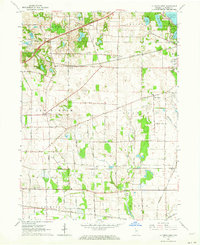
1961 Map of La Porte West
USGS Topo · Published 1964About this map
The Old Indian Treaty Boundary slices diagonally across the northern landscape of this La Porte County region, marking a historic division amidst a complex web of mid-century infrastructure. To the east, the edge of La Porte is visible, featuring the La Porte Fairgrounds, Soldiers Memorial Park, and the County Home. The area is a significant rail corridor, where the New York Central, Wabash, and Baltimore and Ohio railroads converge near small crossroads like Durham and Pinola.
Find a feature on this map
43 named features on this map. Tap any name to fly to it.
Don’t see what you’re looking for? This feature index may not catch every label — zoom into the map to look around manually.
Map Details
Editions of this 1961 La Porte West Map
This is the sole edition of this map. No revisions or reprints were ever made.
Other maps of this area

1953 · Wanatah
USGS Topo · 1:24,000

1953 · Westville
USGS Topo · 1:24,000

1953 · Michigan City West
USGS Topo · 1:24,000

1953 · Chicago
USGS Topo · 1:250,000

1957 · Chicago
USGS Topo · 1:250,000

1958 · Hanna
USGS Topo · 1:24,000

1958 · Kingsford Heights
USGS Topo · 1:24,000

1958 · Michigan City East
USGS Topo · 1:24,000

1958 · La Porte East
USGS Topo · 1:24,000

1958 · Springville
USGS Topo · 1:24,000