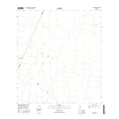
2016 Map of La Reforma
USGS Topo · Published 2016About this map
Puerto Rico and La Reforma anchor this segment of the South Texas brush country along the border of Starr Co and Hidalgo Co. The landscape is defined by vast tracts of open land, where a network of local roads such as FM 1017 and Puerto Rico Rd provides the primary infrastructure for the region.
Find a feature on this map
9 named features on this map. Tap any name to fly to it.
Don’t see what you’re looking for? This feature index may not catch every label — zoom into the map to look around manually.
Map Details
Editions of this 2016 La Reforma Map
This is the sole edition of this map. No revisions or reprints were ever made.
Other maps of this area

1939 · Linn
USGS Topo · 1:62,500

1939 · La Reforma
USGS Topo · 1:62,500

1939 · Encantada
USGS Topo · 1:62,500

1949 · Mc Allen
USGS Topo · 1:250,000

1954 · McAllen
USGS Topo · 1:250,000

1957 · Mc Allen
USGS Topo · 1:250,000

1962 · McAllen
USGS Topo · 1:250,000

1963 · Linn NW
USGS Topo · 1:24,000
1963 · Linn Siding
USGS Topo · 1:24,000
1963 · Hartland
USGS Topo · 1:24,000