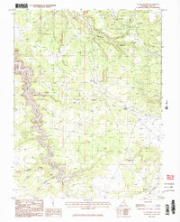
1987 Map of La Sal Junction
USGS Topo · Published 1987About this map
La Sal Junction serves as the focal point of this San Juan County landscape, marking a vital crossroads in the high desert during the late 20th century. The terrain is defined by dramatic geological formations such as the sprawling Flat Iron Mesa and the prominent Black Ridge. The presence of numerous adits and prospect markings indicates a history of mineral exploration throughout the deep cuts of Muleshoe Canyon and Black Canyon.
Find a feature on this map
22 named features on this map. Tap any name to fly to it.
Don’t see what you’re looking for? This feature index may not catch every label — zoom into the map to look around manually.
Map Details
Editions of this 1987 La Sal Junction Map
2 editions found
Other maps of this area

1885 · La Sal
USGS Topo · 1:250,000

1954 · Mt Peale 3 NW
USGS Topo · 1:24,000

1954 · Mt Peale 3 NE
USGS Topo · 1:24,000

1954 · Mt Peale 2 SW
USGS Topo · 1:24,000

1954 · Mt Peale 2 NW
USGS Topo · 1:24,000

1954 · Mt Peale 2 SE
USGS Topo · 1:24,000

1954 · Carlisle 1 NE
USGS Topo · 1:24,000

1954 · Carlisle 1 SE
USGS Topo · 1:24,000

1954 · Mt Peale 2 NE
USGS Topo · 1:24,000

1954 · Carlisle 4 NE
USGS Topo · 1:24,000