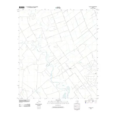
2010 Map of La Salle
USGS Topo · Published 2010About this map
Garcitas Creek meanders through this coastal prairie landscape, defining the character of the area around La Salle. This 2010 survey reflects a rural Texas environment where the economy is driven by energy and agriculture, notably represented by the Vanderbilt Oil Field to the east. The drainage patterns of Venado Creek, Arenosa Creek, and the uniquely named Kentucky Mutt Creek illustrate the low-lying, hydrologically complex terrain near the Texas coast. Local road networks like La Salle Landing Rd and H K Ranch Rd point to the persistent ranching and maritime connections of the region. The layout of La Salle itself shows a structured but sparse settlement pattern, typical of Gulf Coast communities situated between major waterways and regional transit routes like FM 616.
Find a feature on this map
36 named features on this map. Tap any name to fly to it.
Don’t see what you’re looking for? This feature index may not catch every label — zoom into the map to look around manually.
Map Details
Editions of this 2010 La Salle Map
This is the sole edition of this map. No revisions or reprints were ever made.
Other maps of this area

1951 · Inez
USGS Topo · 1:24,000

1952 · Manson
USGS Topo · 1:24,000

1952 · Point Comfort
USGS Topo · 1:24,000

1952 · Edna
USGS Topo · 1:24,000

1952 · Kamey
USGS Topo · 1:24,000

1952 · La Salle
USGS Topo · 1:24,000

1952 · Marcado Creek
USGS Topo · 1:24,000

1952 · Placedo
USGS Topo · 1:24,000

1952 · Lolita
USGS Topo · 1:24,000

1953 · Beeville
USGS Topo · 1:250,000