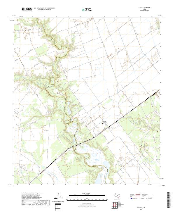
2022 Map of La Salle
USGS Topo · Published 2022About this map
Garcitas Creek winds south through the coastal plains, marking the winding border between Jackson and Victoria counties. This landscape is defined by its sprawling ranchlands and low-lying wetlands, centered on the settlement of La Salle. The map highlights a long history of water access, including Fort Saint Louis Spring and numerous tributaries like Arenosa Cr and Venado Cr that feed into the larger creek system.
Find a feature on this map
48 named features on this map. Tap any name to fly to it.
Don’t see what you’re looking for? This feature index may not catch every label — zoom into the map to look around manually.
Map Details
Editions of this 2022 La Salle Map
This is the sole edition of this map. No revisions or reprints were ever made.
Other maps of this area

1951 · Inez
USGS Topo · 1:24,000

1952 · Manson
USGS Topo · 1:24,000

1952 · Point Comfort
USGS Topo · 1:24,000

1952 · Edna
USGS Topo · 1:24,000

1952 · Kamey
USGS Topo · 1:24,000

1952 · La Salle
USGS Topo · 1:24,000

1952 · Marcado Creek
USGS Topo · 1:24,000

1952 · Placedo
USGS Topo · 1:24,000

1952 · Lolita
USGS Topo · 1:24,000

1953 · Beeville
USGS Topo · 1:250,000