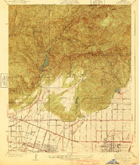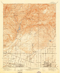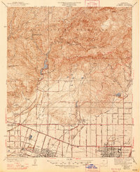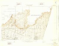
1940 Map of La Verne
USGS Topo · Published 1940About this map
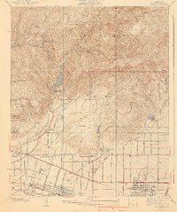
The San Gabriel Mountains dominate the northern landscape of this 1940 survey, giving way to the expanding citrus groves and college towns of the Pomona Valley. The era's water management is prominently displayed through the San Dimas Dam and the Metropolitan Aqueduct, alongside a local Water Softening Plant. The southern half of the map reveals the educational and transit infrastructure of La Verne and Claremont, where the Pacific Electric railway and Foothill Boulevard serve as primary arteries. Local genealogy and institutional history are preserved in the locations of Pomona College, Scripps College, and the Webb School. From the high slopes of Johnstone Peak to the residential streets of the San Jose Addition, the map documents the transition from the wild canyons of the Angeles National Forest to the organized agricultural and academic life of the valley floor.
Find a feature on this map
69 named features on this map. Tap any name to fly to it.
Don’t see what you’re looking for? This feature index may not catch every label — zoom into the map to look around manually.
Map Details
Editions of this 1940 La Verne Map
4 editions found