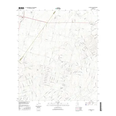
2016 Map of La Vernia SW
USGS Topo · Published 2016About this map
Lone Oak and the outskirts of La Vernia anchor this landscape along the border of Bexar and Wilson counties. The terrain is defined by a series of drainage systems, including Parita Cr and Kicaster Cr, which carve through the elevations marked by prominent features like Rocky Point and Red Bluff. The mapping of these watercourses, including Dry Hollow Cr and Eagle Cr, reveals the natural drainage patterns that have influenced local land use and property boundaries for generations.
Find a feature on this map
155 named features on this map. Tap any name to fly to it.
Don’t see what you’re looking for? This feature index may not catch every label — zoom into the map to look around manually.
Map Details
Editions of this 2016 La Vernia SW Map
This is the sole edition of this map. No revisions or reprints were ever made.
Other maps of this area

1936 · Floresville
USGS Topo · 1:62,500

1953 · Elmendorf
USGS Topo · 1:24,000

1953 · Martinez
USGS Topo · 1:24,000

1954 · San Antonio
USGS Topo · 1:250,000

1957 · San Antonio
USGS Topo · 1:250,000

1957 · New Berlin
USGS Topo · 1:24,000

1958 · La Vernia SW
USGS Topo · 1:24,000

1958 · Saspamco
USGS Topo · 1:24,000
1958 · Saint Hedwig
USGS Topo · 1:24,000
1961 · Marcelinas Hills
USGS Topo · 1:24,000