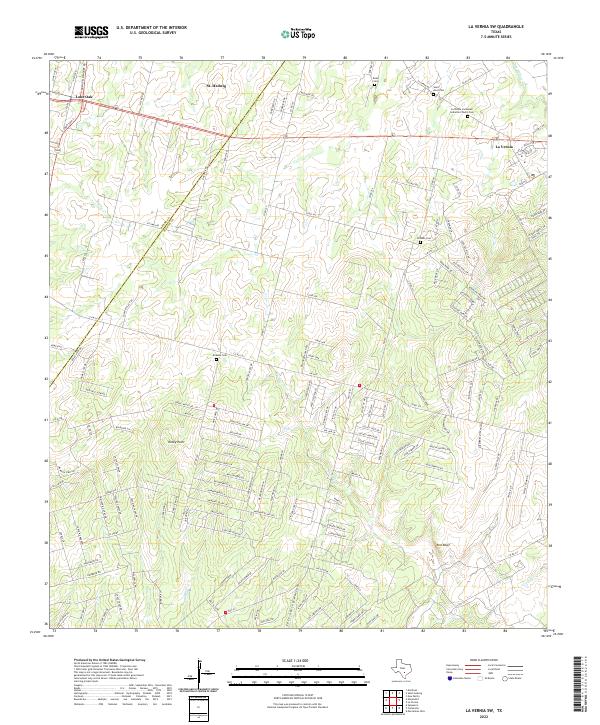
2022 Map of La Vernia SW
USGS Topo · Published 2022About this map
St. Hedwig and La Vernia anchor this landscape along the border of Bexar and Wilson Counties, where the terrain transitions toward the Post Oak Savannah. The map reveals a dense concentration of local heritage sites, including Saint Anns Cem and the La Vernia Immanuel Lutheran Church Cem, which serve as vital markers for genealogical research in these early Texas settlements.
Find a feature on this map
162 named features on this map. Tap any name to fly to it.
Don’t see what you’re looking for? This feature index may not catch every label — zoom into the map to look around manually.
Map Details
Editions of this 2022 La Vernia SW Map
This is the sole edition of this map. No revisions or reprints were ever made.
Other maps of this area

1936 · Floresville
USGS Topo · 1:62,500

1953 · Elmendorf
USGS Topo · 1:24,000

1953 · Martinez
USGS Topo · 1:24,000

1954 · San Antonio
USGS Topo · 1:250,000

1957 · San Antonio
USGS Topo · 1:250,000

1957 · New Berlin
USGS Topo · 1:24,000

1958 · La Vernia SW
USGS Topo · 1:24,000

1958 · Saspamco
USGS Topo · 1:24,000
1958 · Saint Hedwig
USGS Topo · 1:24,000
1961 · Marcelinas Hills
USGS Topo · 1:24,000