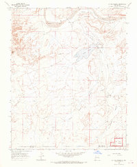
1966 Map of La Vida Mission
USGS Topo · Published 1969About this map
La Vida Mission serves as a primary hub in this desert landscape during the mid-1960s, complete with its own La Vida Mission Landing Strip situated north of the Chaco River. The settlement pattern reflects the specific educational and social infrastructure of the region, anchored by the Lake Valley Boarding School and the Lake Valley Chapter House near Lake Valley. To the south, the map captures a portion of the Chaco Canyon National Monument, marking the intersection of the San Juan and McKinley County line. The terrain is defined by dramatic drainage systems, including Yellow Point Valley and Rock Point Valley, which provide geographical context for historic sites like the Kim-me-ni-oli Ruins. The presence of the Tsaya Trading Post further illustrates the localized commerce essential to this high-desert environment before modern road networks were fully developed.
Find a feature on this map
19 named features on this map. Tap any name to fly to it.
Don’t see what you’re looking for? This feature index may not catch every label — zoom into the map to look around manually.
Map Details
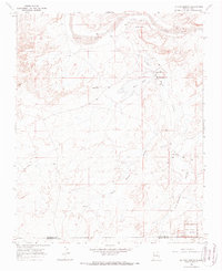
Editions of this 1966 La Vida Mission Map
2 editions found
Other maps of this area

1886 · Wingate
USGS Topo · 1:250,000

1889 · Chaco
USGS Topo · 1:250,000

1892 · Wingate
USGS Topo · 1:250,000

1892 · Chaco
USGS Topo · 1:250,000

1954 · Shiprock
USGS Topo · 1:250,000

1954 · Gallup
USGS Topo · 1:250,000

1958 · Gallup
USGS Topo · 1:250,000

1958 · Shiprock
USGS Topo · 1:250,000

1959 · Shiprock
USGS Topo · 1:250,000

1959 · Gallup
USGS Topo · 1:250,000
Featured Places
- Eastern Navajo Agency, NM
- Tsaya, Eastern Navajo Agency
- Lake Valley, Eastern Navajo Agency
- San Juan County, NM
- McKinley County, NM