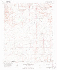
1966 Map of La Vida Mission
USGS Topo · Published 1988About this map
La Vida Mission serves as a focal point for this mid-1960s landscape, positioned near the Chaco River and its own La Vida Mission Landing Strip. The map illustrates a region defined by scattered Navajo community hubs and historic outposts, including the Tsaya Trading Post and the educational grounds of the Lake Valley Boarding School. Towards the south, the terrain descends into the Kim-me-ni-oli Valley, where the Kim-me-ni-oli Ruins offer a glimpse into the ancient ancestral Puebloan heritage of the area, just north of the Chaco Canyon National Monument boundary. This survey captures a specific moment in the rural development of the San Juan and McKinley county line, where community life is centered around the Lake Valley Chapter House and local geographical landmarks like Yellow Point and Juans Lake.
Find a feature on this map
15 named features on this map. Tap any name to fly to it.
Don’t see what you’re looking for? This feature index may not catch every label — zoom into the map to look around manually.
Map Details
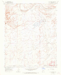
Editions of this 1966 La Vida Mission Map
2 editions found
Other maps of this area

1886 · Wingate
USGS Topo · 1:250,000

1889 · Chaco
USGS Topo · 1:250,000

1892 · Wingate
USGS Topo · 1:250,000

1892 · Chaco
USGS Topo · 1:250,000

1954 · Shiprock
USGS Topo · 1:250,000

1954 · Gallup
USGS Topo · 1:250,000

1958 · Gallup
USGS Topo · 1:250,000

1958 · Shiprock
USGS Topo · 1:250,000

1959 · Shiprock
USGS Topo · 1:250,000

1959 · Gallup
USGS Topo · 1:250,000
Featured Places
- Eastern Navajo Agency, NM
- Tsaya, Eastern Navajo Agency
- Lake Valley, Eastern Navajo Agency
- San Juan County, NM
- McKinley County, NM