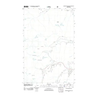
2011 Map of Labyrinth Mountain
USGS Topo · Published 2011About this map
The Old Cascade Tunnel anchors the southwest corner of this high-elevation terrain, marking a significant engineering point in the crossing of the Cascades. The map details a complex network of alpine water bodies and drainages, including Minotaur Lake, Theseus Lake, and Lake Valhalla, which sit below prominent peaks such as Labyrinth Mountain and Mount McCausland. Along the southern corridor, Stevens Rd follows the course of Nason Creek, providing access to recreational sites like the Totem Girl Scout Org Camp. The landscape is defined by its steep glacial geography, illustrated by the sharp transitions from Union Gap down to the headwaters of the Rapid River. This survey captures the specific arrangement of Forest Service infrastructure and established campgrounds, such as the Theseus Creek Campground, at a time when these high-country routes remained essential for both transit and recreation.
Find a feature on this map
34 named features on this map. Tap any name to fly to it.
Don’t see what you’re looking for? This feature index may not catch every label — zoom into the map to look around manually.
Map Details
Editions of this 2011 Labyrinth Mountain Map
This is the sole edition of this map. No revisions or reprints were ever made.
Other maps of this area

1901 · Chiwaukum
USGS Topo · 1:125,000

1902 · Skykomish
USGS Topo · 1:125,000

1904 · Chiwaukum
USGS Topo · 1:125,000

1905 · Skykomish
USGS Topo · 1:125,000

1957 · Wenatchee
USGS Topo · 1:250,000

1965 · Captain Point
USGS Topo · 1:24,000

1965 · Chiwaukum Mts
USGS Topo · 1:62,500

1965 · Stevens Pass
USGS Topo · 1:24,000

1965 · Wenatchee Lake
USGS Topo · 1:62,500

1965 · Poe Mountain
USGS Topo · 1:24,000