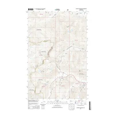
2014 Map of Labyrinth Mountain
USGS Topo · Published 2014About this map
Cascade Tunnel and its predecessor, the Old Cascade Tunnel, anchor the southern portion of this high-elevation landscape, illustrating the critical rail crossing through the Cascades. The map details the convergence of the Wenatchee National Forest and Snoqualmie National Forest across the county lines of King, Chelan, and Snohomish. High-altitude hydrology is a primary focus, with numerous basins containing Minotaur Lake, Lake Valhalla, Jove Lake, and Theseus Lake. The Pacific Crest National Scenic Trail winds through the central corridor, passing prominent summits like Labyrinth Mtn and Lichtenberg Mtn. Near US Hwy 2, the presence of the Totem Girl Scout Org Camp and Theseus Creek Campground points to the area's established role as a recreational and organizational destination within the national forest system.
Find a feature on this map
51 named features on this map. Tap any name to fly to it.
Don’t see what you’re looking for? This feature index may not catch every label — zoom into the map to look around manually.
Map Details
Editions of this 2014 Labyrinth Mountain Map
This is the sole edition of this map. No revisions or reprints were ever made.
Other maps of this area

1901 · Chiwaukum
USGS Topo · 1:125,000

1902 · Skykomish
USGS Topo · 1:125,000

1904 · Chiwaukum
USGS Topo · 1:125,000

1905 · Skykomish
USGS Topo · 1:125,000

1957 · Wenatchee
USGS Topo · 1:250,000

1965 · Captain Point
USGS Topo · 1:24,000

1965 · Chiwaukum Mts
USGS Topo · 1:62,500

1965 · Stevens Pass
USGS Topo · 1:24,000

1965 · Wenatchee Lake
USGS Topo · 1:62,500

1965 · Poe Mountain
USGS Topo · 1:24,000