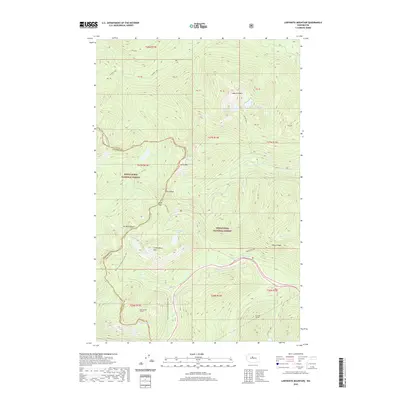
2020 Map of Labyrinth Mountain
USGS Topo · Published 2020About this map
The Pacific Crest National Scenic Trail winds along the high ridges where the boundaries of Snoqualmie National Forest and Wenatchee National Forest meet. This alpine landscape is defined by its deep lakes and steep peaks, including the prominent Labyrinth Mtn and Mt McCausland. Transit through this difficult terrain is marked by significant engineering, notably the Cascade Tunnel and its predecessor, the Old Cascade Tunnel, which provided a critical rail link through the Cascades. Below the peaks, numerous water bodies such as Lake Valhalla, Minotaur Lake, and Lake Janus sit in glacial cirques, feeding streams like Nason Cr and the Rapid River. The map also illustrates the Bygone Byways route, reflecting the area's history of travel and transport.
Find a feature on this map
51 named features on this map. Tap any name to fly to it.
Don’t see what you’re looking for? This feature index may not catch every label — zoom into the map to look around manually.
Map Details
Editions of this 2020 Labyrinth Mountain Map
This is the sole edition of this map. No revisions or reprints were ever made.
Other maps of this area

1901 · Chiwaukum
USGS Topo · 1:125,000

1902 · Skykomish
USGS Topo · 1:125,000

1904 · Chiwaukum
USGS Topo · 1:125,000

1905 · Skykomish
USGS Topo · 1:125,000

1957 · Wenatchee
USGS Topo · 1:250,000

1965 · Captain Point
USGS Topo · 1:24,000

1965 · Chiwaukum Mts
USGS Topo · 1:62,500

1965 · Stevens Pass
USGS Topo · 1:24,000

1965 · Wenatchee Lake
USGS Topo · 1:62,500

1965 · Poe Mountain
USGS Topo · 1:24,000