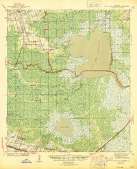
1944 Map of Lac Des Allemands
USGS Topo · Published 1944About this map
Lac Des Allemands dominates this coastal Louisiana landscape, where the intricate networks of bayous and man-made canals define the 1930s economy. Agricultural life is centered around the Bayou Lafourche corridor and the higher ground near Vacherie, featuring significant landmarks like Golden Star Plantation, Webster Plantation, and Melodia Plantation. The mapping captures a specific moment in Cajun country's infrastructure, showing the Southern Pacific railroad line serving the settlements of Rousseau and Ewing while a system of waterways, including the Dredge Boat Canal and Narrow Gage Canal, facilitates drainage and transport through the Rathborne Swamp. Community hubs are anchored by local institutions such as St Lawrence Ch in Bayou Boeuf and the Marse Sch, providing essential geographic markers for genealogical research in St. James and Lafourche parishes.
Find a feature on this map
49 named features on this map. Tap any name to fly to it.
Don’t see what you’re looking for? This feature index may not catch every label — zoom into the map to look around manually.
Map Details
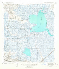
Editions of this 1944 Lac Des Allemands Map
2 editions found
Other maps of this area

1891 · Hahnville
USGS Topo · 1:62,500

1892 · Lac Des Allemands
USGS Topo · 1:62,500

1892 · Mount Airy
USGS Topo · 1:62,500

1892 · Gibson
USGS Topo · 1:62,500

1892 · Bonnet Carre
USGS Topo · 1:62,500

1892 · Cut-Off
USGS Topo · 1:62,500

1892 · Houma
USGS Topo · 1:62,500

1892 · Donaldsonville
USGS Topo · 1:62,500

1892 · Thibodaux
USGS Topo · 1:62,500

1897 · Gibson
USGS Topo · 1:62,500