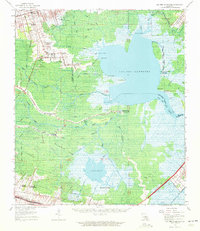
1962 Map of Lac Des Allemands
USGS Topo · Published 1972About this map
Webre Steib Plantation and Southdown Plantation anchor the agricultural landscape of the upper bank, where the land transitions into the expansive Rathborne Swamp. This 1960s environment is defined by its intricate water network, dominated by the massive Lac Des Allemands and Lake Boeuf. The mapping reveals a distinct settlement pattern following the natural levees of Bayou Lafourche, where the Southern Pacific railroad parallels the waterway through Rousseau and Ewing. Inland, isolated communities like Kraemer and Bayou Boeuf are linked by Route 307, carving paths through the cypress and tupelo wetlands. Economic activity in the mid-century is marked by extractive industries, evidenced by the Lac Des Allemands Gas Field and Lucy Gas Field, alongside traditional river-dependent life centered around landmarks like St Lawrence Ch and Choctaw Sch.
Find a feature on this map
66 named features on this map. Tap any name to fly to it.
Don’t see what you’re looking for? This feature index may not catch every label — zoom into the map to look around manually.
Map Details
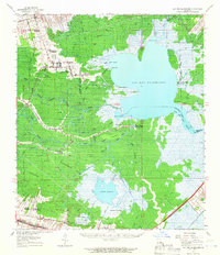
Editions of this 1962 Lac Des Allemands Map
2 editions found
Other maps of this area

1891 · Hahnville
USGS Topo · 1:62,500

1892 · Lac Des Allemands
USGS Topo · 1:62,500

1892 · Mount Airy
USGS Topo · 1:62,500

1892 · Gibson
USGS Topo · 1:62,500

1892 · Bonnet Carre
USGS Topo · 1:62,500

1892 · Cut-Off
USGS Topo · 1:62,500

1892 · Houma
USGS Topo · 1:62,500

1892 · Donaldsonville
USGS Topo · 1:62,500

1892 · Thibodaux
USGS Topo · 1:62,500

1897 · Gibson
USGS Topo · 1:62,500